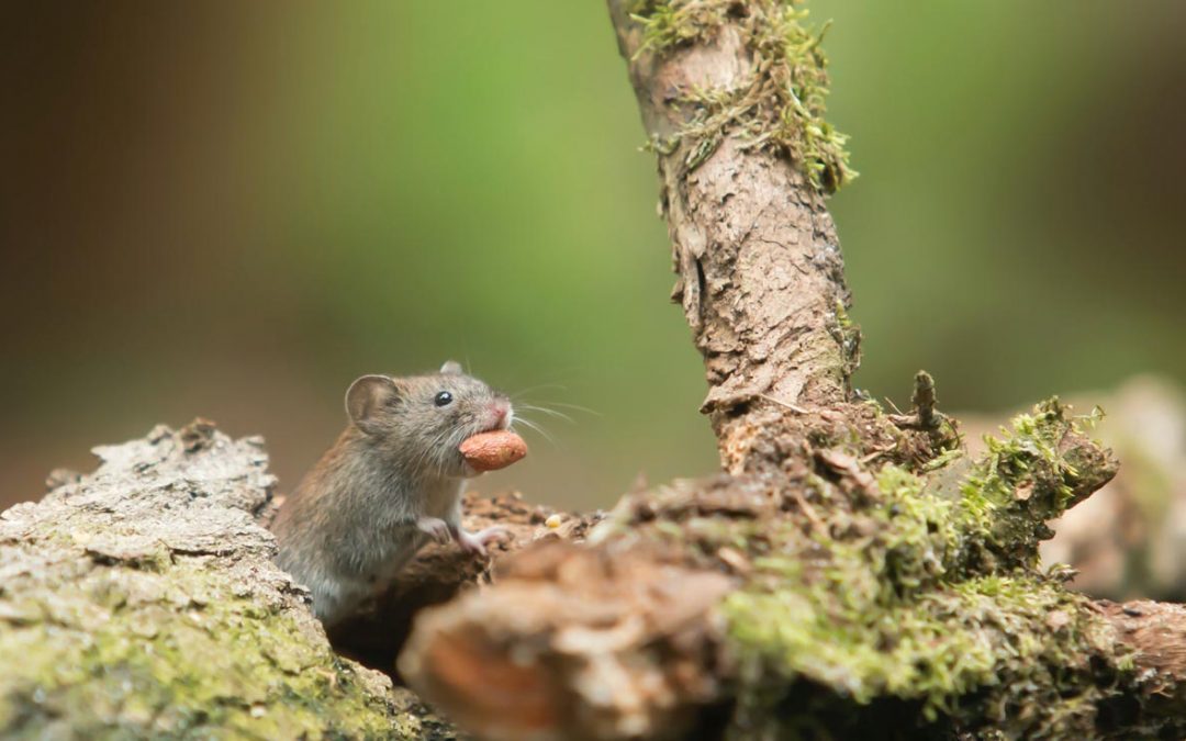


How to Treat Termites
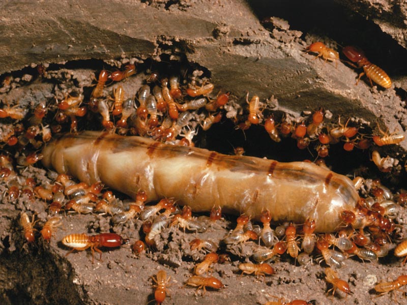
Highly destructive and hard to detect, termites are thought to cost Adelaide homeowners between $5,000 to $10,000 per year in repair bills. Find out how to treat termites infesting your home in today’s Hivemind blog.
What questions will this article answer?
How to treat termites in your home or business
Estimated to cost billions to repair every year, termite damage is a widespread issue to homes and businesses all across Australia. Unfortunately, this is not claimable through insurance as it is deemed to be highly preventable. So it’s no surprise that termite protection is a serious matter.
So, how do you treat termites in your house? Chances are, you’ll see the destruction they’ve caused before you actually see them in action. To limit further problems in your home, we recommend calling a professional pest control service ASAP as the best course of action.
However, there are a couple of DIY solutions that may come in useful the meantime. Keep reading to learn more!
Diatomaceous earth
This can be helpful if you’re wondering how to treat termites in a house naturally. Readily available from hardware stores for purchase, diatomaceous earth is a fine powder with naturally abrasive properties that can puncture a termite’s exoskeleton, leading to moisture loss. You can sprinkle this around the perimeter of your home, as well as potential entry sites and areas with high termite activity.
Boric acid
A slow-acting but versatile termite treatment option, boric acid damages a termite’s outer shell, and can be purchased in a powdered form. You can sprinkle it directly around the perimeter of your home to prevent termite entry, where it will also penetrate deep into small crevices. Or, mix it with just enough water to form a thick paste and spread it over infested timber with a brush. You can even dissolve a teaspoon in a cup of warm water to make a spray.
Worried about termites in your home? Speak to an expert today
 or
or
White vinegar
With its high acidic content and disinfectant properties, white vinegar works to dehydrate termites and remove their pheromone scent trails. You can prepare a solution with equal parts of vinegar and water mixed together, along with a squeeze of lemon juice to further bump up the acidity level. Spray this potent acidic concoction over areas with damp wood, including foundations.
Essential oils
With natural insecticide properties, the following essential oils are effective against termites as well as a range of other crawling insects:
Clove oil
Use a few drops of clove oil mixed with water to spray around termite hotspots.
Neem oil
With an unpleasant, bitter smell, neem oil disrupts termite growth hormones and developmental processes. It can be injected directly into damaged wood to target termites, or you can make a spray with 1 tablespoon of neem oil to 2 litres of water, with a dash of liquid detergent. You can apply this directly to termites, hollow timber structures and potential entry points such as door and window frames.
Orange oil
Containing d-limonene, an active ingredient which breaks down termite exoskeletons and metabolic processes, orange oil can be diluted with water and sprayed over termite hotspots, mud tubes and affected timber.
Cardboard traps
For cellulose- and moisture-loving termites, wet cardboard traps are not only an effective bait but are also extremely easy to prepare. All you’ll need are a few pieces of flat, corrugated cardboard soaked in water. You can stack them in areas of high termite activity, for example, near mud tubes or damaged wood. If you’re wanting to know how to treat termites in a wall, place a cardboard trap against it and watch for termite activity. Remember to check these traps daily and replace them frequently.
Don’t let termites invade your walls, get expert advice on how to treat termites in wall structures today.
or
Petroleum jelly
Thick, impermeable and sometimes laced with phenol, petroleum jelly is a surprisingly useful termite deterrent as it starves termites of oxygen. You can apply it liberally to timber-based surfaces and structures to create a tough physical barrier to termite entry.
Salt
As one of the best and most easily accessible dehydrating agents around, salt will draw water away from termites, who rely heavily upon moisture to survive.
You can simply sprinkle salt around problem areas or make a strong saline spray by dissolving a large amount of salt in warm water.
Nematode worms
As natural termite predators with a particular appetite for larvae,nematode worms are useful in controlling a termite population. Being microscopic in size, they’re able to crawl inside a termite’s body through tiny openings, then release poisonous bacteria.
These worms are not harmful for people, pets or the ecology of your yard.
Safeguard your property from sneaky termites, speak to an expert today
or
Professional termite control
The best way to combat termites is to prevent them from venturing near your home in the first place. While you can do your best at reducing sources of moisture around your yard and removing dead tree stumps and woodpiles, subterranean termites happen to be very discreet in their movements. You could still miss the earliest signs of an outbreak.
If you’ve tried DIY options and are still wondering how to treat termites at home safely and for good, professional intervention is the most reliable solution.
Yearly termite inspections
At Allstate, we recommend yearly termite inspections by licensed termite inspectors, per government regulations, to ensure that you and your family stay safe from infestation. More frequent inspections may be required if your property is considered as high risk, for example, if you live near a creek, or your home has previously had a termite issue.
Premise termite treatment spray
If termites are detected at your inspection, we offer a fast-acting treatment that can be applied directly to the soil and foundations underneath your home. Premise non-repellent termiticide spray contains imidacloprid, a targeted active ingredient that works within days to disrupt the termite nervous system and reduce the termite population.
Sentricon Always Active termite bait stations
For the best long-term protection, we recommend having a Sentricon termite barrier installed around your property. With stations positioned underground, 30 centimetres away from the walls of your home, spaced 3 metres apart, the baits are embedded with a powerful termiticide called hexaflumuron. When our clients ask us how to best treat termites at home, you can’t beat a Sentricon system.
Choose Allstate for reliable and long-lasting termite management
If you’re noticing signs of termites around your yard, chances are that it’s only a matter of time before they begin to compromise the structure of your home.
At Allstate, we’ve been protecting homes and businesses from termite attacks since 1986.
Available 24/7 for urgent enquiries, our licensed pest technicians are fully equipped and highly trained to offer comprehensive termite inspections and targeted termite treatments.
Covered by competitive warranties and with payment plans on offer, you can have our experts at Allstate over to termite proof your home today.