


Effective Pest Solutions for Midges in House Problems
Homeowners and renters across Adelaide know how frustrating midges can be in house corners. You sit down after a long day, and instead of peace, you’re swatting tiny flying insects that leave itchy bites and disrupt your sleep.
For families in coastal areas or homes with damp spots, biting midges are a nuisance and constant irritation. So, how do you manage midges in the house?
It starts with identifying what attracts them: moisture, light, and organic matter, and then optionally implementing the right pest control steps with the help of a pest control service like Allstate Pest Control.
What Are Midges?
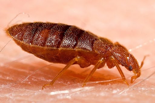
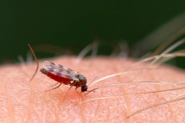
Midges are small flying and biting insects. They belong to the same order as mosquitoes and gnats. But they’re much smaller. Yet, some midge species are known to be far worse than mosquitoes!
However, many species are harmless, feeding on plants and decaying matter. Others, like biting midges, feed on exposed skin and can leave painful, itchy welts.
They’re commonly found around water sources such as wetlands, rivers, and coastal areas.
According to the Government of Western Australia, biting midges are most active at dawn and dusk, particularly in humid weather and calm conditions. While they don’t spread diseases in Australia, their bites can cause discomfort, allergic reactions, and disturbed sleep.
What Attracts Midges in the House?
Midges don’t wander indoors by chance. They’re drawn by several factors:
Moisture is a big one! Damp areas in bathrooms, kitchens, and laundry rooms provide the perfect breeding ground for larvae.
Light is another attractant. Adult midges often swarm around bright indoor lamps, especially at night when windows or doors are left open.
Standing water also plays a role. Buckets, pet bowls, or trays under pot plants can become breeding sites where eggs hatch.
Lastly, organic matter. Food scraps, decaying fruit, or damp soil in potted plants can keep midge activity high indoors.
How to Get Rid of Midges in the House
You don’t have to live with them. Here’s how you can reduce or stop an infestation.
• Start by removing standing water: Empty pet bowls daily and tip out water sources like plant saucers.
• Use fly screens: Properly fitted screens help keep out midges, mosquitoes, and other flying insects.
• Clean on a regular basis: Wipe kitchen benches, take out bins quickly, and avoid leaving fruit exposed.
• Try natural options: Bowls of apple cider vinegar mixed with dish soap can act as simple traps for gnats and midges.
• Set up traps near windows or light sources: These can catch adult midges attracted to brightness.
• Use insecticides carefully: Sprays designed for flying insects can reduce adult populations, but should be applied with care.
And importantly, call a biting insect control professional. At Allstate Pest Control, our insect control service in Adelaide provides personalised solutions, safe treatments, and long-term preventative measures.
Preventing Future Midge Problems
Prevention works better than constant treatment. Here’s how to protect your home and family from future midge problems:
1. Seal entry points around windows, doors, and vents to keep adult midges outside.
2. Maintain outdoor areas. Keep lawns trimmed, remove rotting vegetation, and clear drains of stagnant water.
3. Stick to regular cleaning indoors. Wash bins often, wipe spills quickly, and check pot plants for damp soil.
Simple preventative measures like these cut down breeding opportunities and reduce the chance of large numbers settling in your home.
Why Choose Allstate Pest Control for Midge Infestations in Adelaide?
We know midges. With decades of local experience, we understand South Australia’s climate, pests, and problem spots better than anyone else.
Our services cover all biting insects, from mosquitoes to gnats and bees & wasps, ensuring your home or business is protected year-round. We also use eco-friendly options where possible; they are designed to protect humans, pets, and the environment.
Most importantly, we also help identify breeding grounds, reduce future risks, and give you back peace of mind.
Frequently Asked Questions
What attracts midges to my house?
Midges are mainly drawn to light, moisture, and organic matter. In Adelaide, they often gather around bathroom drains, damp laundry areas, or pot plant soil. Biting midges breed in wet sand, mud, or decaying vegetation, making homes near coastal areas or wetlands more vulnerable. Even a bowl of fruit left out overnight can attract large numbers of insects indoors.
How can I prevent midges from coming into my house?
Installing fine mesh fly screens with gaps smaller than 1mm can physically block midges, as their bodies are tiny (often less than 3mm). Regularly emptying water sources like pot plant saucers or pet bowls is crucial, since eggs and larvae develop in damp environments. Cleaning bins with boiling water and sealing food reduces breeding opportunities inside.
Are midge bites harmful?
Biting midges don’t transmit diseases in Australia, but their bites can be extremely irritating. The saliva they inject causes an allergic reaction in most people, leading to itchy red welts that may last for days. For those with allergies, scratching can break the skin and increase the risk of secondary infection.
Take Back Your Home from Midges
Dealing with midges is not only frustrating. It disrupts sleep, comfort, and everyday living. You don’t need to put up with them.
If you’ve noticed biting midges in house corners, or swarms of tiny flies near lights, it’s time to act. Call Allstate Pest Control today on (08) 8371 1277 for fast, reliable support across Adelaide.